


By Aaron Nathan
First, what is dead reckoning? It has nothing to do with death or dead people
For many centuries, travelers have used “Dead reckoning” to get from one part of the world to another. The term refers to deriving a position based on the direction and speed of travel from a starting point.

Today, this is also known as inertial sensing, and in practice, it looks totally different from the original applications of mariners or explorers. However, the foundational logic of dead reckoning remains relatively the same as it has been for hundreds of years.
For example, in vehicles, modern inertial sensors measure the rate of rotation and the level acceleration of the vehicle chassis. This includes effects like gravity, acceleration under braking and cornering, and even sitting perfectly still. Additionally, rotary encoders measure how many rotations of each wheel occur over a period of time. By integrating all of this data and applying some of the laws of physics, we can determine how fast the vehicle is going and in what direction. Using this information, the navigation system can calculate the car’s location based on where and when it started moving.
While advancements in MEMS and measurement technologies have made inertial sensing more widely available and informative, it’s important to note it does not replace other positioning systems. Rather, dead reckoning is part of an ecosystem of tools that, when combined, produce the most precise positioning data for use in various applications. This is primarily because all sensors have errors, which in dead reckoning can amount to very large position errors if used for long periods of time. For instance, if a vehicle calculated the heading angle to be incorrect by only 0.1 degrees, over a 1km tunnel, it would have accumulated nearly 2m of position error at the exit. This need for precision makes dead reckoning easy to understand but difficult to implement well in practical applications.
Inertial sensing & dual-band GNSS
GNSS technology is largely considered the gold standard for absolute positioning, especially given the rise of multi-band solutions. In reality though, the optimum solution is a tech stack of dead reckoning and GNSS technology tightly fused as one that provides precise positioning from satellites and complements that data with inertial sensing to bridge gaps caused by signal unavailability, augment navigation systems and aid in detecting satellite signal errors.
Inertial sensing and dead reckoning is particularly useful when it is impossible to get an accurate GNSS signal. In a tunnel, in a covered parking lot, or even in an urban canyon where satellite signals are bouncing around or are not available, inertial sensing remains highly available. The most advanced solutions will ‘learn’ the errors in the dead reckoning solution while in open sky environments and then subtract out these errors in the future to drastically improve the accuracy of the inertial sensors and other elements.
Multi or dual-band solutions have greatly improved GNSS positioning accuracy and have become more accessible in the past few years. There are many causes of GNSS positioning errors – more on that here – but multipath errors occur when signals take 2 or more paths from the transmitter (the satellite) to the receiver. An example is when part of the signal reflects off a building before reaching the antenna, while a split of that signal travels directly to the antenna. Dual-band solutions can better measure these discrepancies by tracking signal bands from multiple frequencies and derive more precise positioning. However, there are still many situations in which GNSS is insufficient, and dead reckoning is needed to fill in the gaps and provide additional context for the most accurate positioning.
Why Might GNSS Not Work?
Despite continued innovation in the industry, sometimes GNSS just doesn’t cut it. Here are the top five scenarios when inertial sensing is needed to provide precise positioning to complement GNSS.
1. Deriving positioning information during signal outages

The most common reason for using dead reckoning is to fill positioning gaps caused by GNSS signal outages. Outages occur when signals are obstructed and cannot reach receivers, such as when traveling through a dense urban environment, in a covered parking lot, or in a tunnel.
As inertial signals are based on gravity and the laws of physics, they are immune to environmental factors. In these instances, inertial sensors provide highly accurate positioning information based on speed, direction, and altitude. Remember, though, there are a few different ways to implement dead reckoning in this situation. We wrote about them here so you can choose the method that best suits your particular use case.
2. Aiding GNSS position estimation to improve data quality
Similarly, dead reckoning can augment positioning calculations when GNSS signal quality is poor. The same factors that can completely obstruct signals can also severely degrade their quality, and sometimes, even other sources of RF interference (think nearby cell towers or modems) can play a role. Although signals are not completely obstructed, making them technically usable for deriving location, this decreased quality can greatly impact positioning calculation accuracy. At these times, you can use data collected by inertial sensors to estimate position better.
3. Collecting data
An additional benefit of inertial sensors is their ability to continuously capture data specific to the vehicle or piece of hardware it is connected to. While it is possible to observe positioning history from GNSS and RTK data, dead reckoning solutions collect data about the unique movement of the object they are attached to, including speed, direction, altitude, and more. While this data is primarily captured to fuel positioning calculations when GNSS fails, it provides the added benefit of showing movement history you cannot derive from GNSS signal data directly – although you can directly calculate speed and altitude.. You can use these insights to track driving behavior, autonomous vehicle (AV) performance, and similar trends.
4. Improving speed and affordability

GNSS solutions are computationally expensive, usually occurring at 1 Hz or 10 Hz. Inertial measurements can occur at 100 Hz or higher and can dead reckon between GNSS updates to provide positioning data for geotagging cameras and complementing LiDAR or radar data. A car driving down the highway can travel with approximately 3m in between GPS updates – a huge amount of error for a sensor like LiDAR. Having higher accuracy in between GPS updates is crucial. IMUs are often used to interpolate between GPS updates, allowing you to get high frequency, high resolution position solutions that line up much closer with the timing of your sensor data from LiDAR, camera, and radar.
5. Providing protection against spoofing or signal jamming

Last – but certainly not least – inertial sensors provide foundational positioning information that can be relied on when GNSS signals are compromised. Unfortunately, today’s GNSS users must contend with the possibility of hackers jamming or spoofing their receivers. While this is relatively rare for consumer positioning, large-scale GNSS commercial or intelligence applications must maintain a backup to avoid making critical decisions based on inaccurate information. That’s where dead reckoning comes in; inertial sensors provide reliable positioning data free from outside influence to enhance the resilience of location-based technology. In fact, inertial systems tell you that you are being spoofed, and once detected, allow you to dead reckon until GNSS can be trusted again.
Get started with high-precision dead reckoning
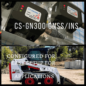
At Point One, we specialize in providing the most precise, affordable, and accessible positioning technology to power location-based applications worldwide. Our inertial navigation offerings implement our leading sensor fusion algorithms, enabling high-precision positioning for a wide variety of use cases.
Atlas and FusionEngine make it possible to easily build with robust position and navigation information, and to include this information into a product or system with minimal engineering effort. You can learn more about the technical specs of our inertial navigation system here, including details about our tightly-coupled sensor fusion, centimeter-level accuracy, and open sky vs. urban performance metrics.
To get started with Point One’s automotive-grade sensors, purchase a dev kit and get in touch with our team of experts.


